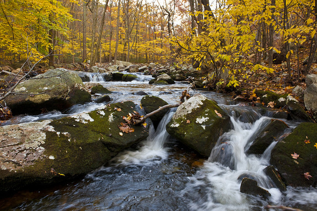
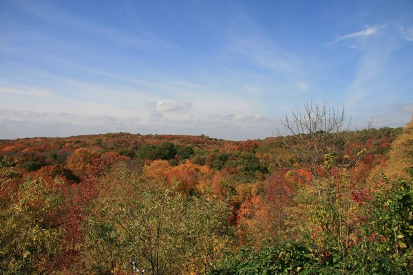
Fall is most definitely here, but don’t worry, you can still get outside! ‘Tis the season to escape from New York and be one with the trees for a day. Bring water, bring snacks, bring friends, and head to one of these hikes that you can get to without a car.
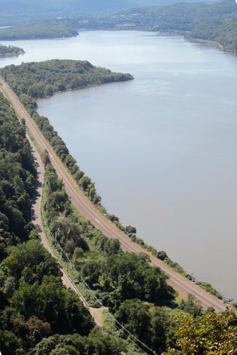
Breakneck Ridge
A hop, skip and a jump up the Hudson on the Metro-North will lead you right to a scramble up some steep trails, expediently elevating you to views as breathtaking as the ascent. A mellow comedown through the woods will take you to the town of Cold Spring (or, if you’re feeling ambitious and/or antiquey, Beacon), where you can stop in for some suds and grab some grub. If you do head to Beacon (just follow the white trail), you get to scale a pretty sweet fire tower along the way, and in town there’s a delicious gastropub with a rotating selection of a bunch of craft beer from near and far. If scratch-made tacos are more your style, try Tito Santana Taqueria instead (you still get to drink local craft draft beer) before catching your train back (you’ll have earned it).
Take the Hudson Line from Grand Central to Breakneck Ridge (weekends and holidays only, two trains departing in the morning [check schedules]), and train back from Beacon or Cold Spring after the hike. Train ride 1 1/2 hours in either direction, $30 round-trip. 5+ hour hike. Strenuous (in parts).
________________________________________

Blue Mountain Reservation
More of a stroll compared to Breakneck’s strain–unless, of course, you want to make it one. A decent, 1500 acre+ park full of hiking and [mountain] biking trails (map here). Climb a “mountain” (i.e. Spitzenberg or, of course, the namesake Blue Mountain, neither of which is over 700 ft in elevation), stroll through the woods, and take in the views. If you’re looking for something more ambitious, you can always get off at Croton-Harmon station instead and hike up and into Blue Mountain Reservation via the Briarcliff-Peekskill Trailway (approximately 10 miles, between the walk to the trail and the trail north to Peekskill). Don’t forget to check out the Peekskill Brewery by the train station on your ride back (with good grub to boot! This author’s favorite beverage is the Eastern Standard).
Take the [beautiful] Hudson line from Grand Central to Peekskill, walk up Hudson Ave, take a right on Washington Street, and [eventually] a left on Lounsbury Lane to get to the park entrance (1.5 mile stroll from train station to park entrance). Train ride 1 hr 5 mins in either direction, $25 round-trip. Moderate.
________________________________________
Harriman State Park
With views less dramatic and no apples to speak of, this is acres upon acres of no-nonsense hiking. In addition to boasting a bunch of woods to explore, there are campsites and stuff (the Appalachian Trail goes through here!), so you can get lost quite literally for days in this accessible wilderness if you feel like it. Pro-tip: buy a trail map ($10) ahead of time or from the Tuxedo Park public library across the street (and just south of) the train station. Hike up to the Dutch Doctor shelter if you want to camp or past it to check out, or swim in, a couple of lakes (rumor has it there’s a rope swing there).
Take a train, any train to Secaucus from Penn Station; transfer to the Metro-North Port Jervis line and get off at Tuxedo (from there, just walk into the woods). Train ride approx. 1 hr 15 mins in either direction, $27 round-trip. Mellow to moderate.
________________________________________
New York City
Wait, what?! I thought we were supposed to escape from New York? Turns out, it’s not the dystopian maximum-security prison it was supposed to be by 1997, and it’s got a few green gems (emeralds?) of its own to check out.
Staten Island Greenbelt
Thousands of acres of [sub]urban wilderness, now accessible via bike bus! Here in the fifth borough, you can explore the woods of High Rock Park, go for a carousel ride, or take in the view from Moses’ Mountain, a 260-foot high hill made from a failed Moses highway through Staten Island.
Take the S53 or an express bus ($6.50 one-way) from downtown Manhattan or S93 (if you want to bring your bike) to Staten Island; or if you prefer the ferry, take the famous Staten Island Ferry, transfer to the Staten Island Railway at St. George landing, taking it to New Dorp (this is also the final destination on the bus), and walking in from there (about a mile). Trail map here. Mellow.
Jamaica Bay Wildlife Refuge
An ornithologist’s paradise, home to all sorts of birds both natural and man-made (JFK’s, like, right next door if your idea of birding is identifying Boeings and Airbuses instead of condors and cranes).
Take the A towards Far Rockaway (get off at Broad Chanel and walk a mile up Cross Bay Blvd) to get to the Jamaica Bay Wildlife refuge. Mellow.
New York Botanical Garden
Two hundred fifty acres of gardens, trees, and cacti right next to the Bronx Zoo. They’ve got a famous greenhouse, rotating special exhibit, and, heck, you can go check out the caged animals at the Bronx Zoo (next door) if you get bored. While you’re up in the Bronx, don’t forget Van Cortlandt Park (even bigger) and Pelham Bay Park (the biggest).
Take the Harlem line on the Metro-North from Grand Central to the Botanic Garden stop, or take the 4 uptown to the Bedford Park Blvd stop and walk (20 mins) down Bedford Park Blvd. If you do opt for Pelham Bay, take the 6 all the way to the end, and protip: stop at the Bronx Brewery on the way back (Cypress Ave). Mellow.
________________________________________

Brooklyn-Queens Greenway
Get to know the wild side of Brooklyn’s big spoon, Queens, a little more intimately. You can find a map to each piece of the Greenway, which spans 40 miles through Brooklyn and Queens, but we’re focusing on the 15.3 mile stretch from the Ridgewood Reservoir to Flushing Meadows Park. Starting at Broadway Junction (A,C,J,Z,L), walk east on Jamaica Avenue, hook a left up Miller Avenue, and then a right on Highland Blvd, which will bring you to a triangular junction with Vermont Place and to the steps up to the Ridgewood Reservoir! A little oasis over and away from the sprawling metropolis which surrounds it, this little body of water served as a backup water supply for the city as recently as 1989. Now it’s home to birds, marshgrasses, and serenity. From there, you can hike through Forest Park, a small a selection of trails and wilderness (make sure you look out for the carousel as you cross Woodhaven Boulevard onto East Main Drive), before you come to Flushing Meadows Corona Park. Look to your left: you’ll see Meadow Lake; walk along that, take the footbridge over the LIE, and descend into the 1939 World’s Fair of yesteryear! Once a Gatsbian ash heap, New York did it up right in ’39 and ’64, with such relics as a giant, vaguely topographical globe (the Unisphere!) and its own now defunct but still colorful state pavilion. The Panorama, a scale-model of all the buildings in New York City at the time of its construction, at the Queens Museum of Art and pretty rad nearby Mexican food, perhaps consisting of tacos made from tortillas made on location, will make everything worth the schlep. Congratulations! Now that you’re done, you can ride the 7 to the back to wherever you live.
Moderate hike
And there you have it, Broketown: how to get out of town and into some trees!
Related Articles
“Embrace Your Hyphen” at Brooklyn Borough Hall This Sunday
Sample cuisine and culture from around the world.
North Brooklyn’s best wine happy hours and cheap wine deals
Wine might be thought of as a booze for fancy people, but North Brooklyn has enough awesome wine happy hours to make sure any schlub can afford it.
5 Comments
Leave a Reply
Love it — but have to take issue with a couple statements about Harriman. On Saturday all through summer and into fall there’s a farmers market with apples in abundance, right at the Tuxedo train station. You’ll find more fruit to pick within the park in season: blueberries, huckleberries, grapes, elderberries, serviceberries. And finally, views are dramatic everywhere in Harriman, plus caves, lean-to shelters and nice lakes and streams. Breakneck’s cool but for variety and as a place I go to again and again, it’s Harriman. (There’s a shuttle on the weekend in spring-fall that takes you from the train station into the park, so your hike can be any length you want back to the train station).
Thanks, Wes, for filling in the gaps on Harriman! It’s by far the largest of the parks mentioned, and you’re right in that there’s a lot to see (and eat) there. I’ve found the best views to be in the hillier northeastern section of the park, by Bear Mountain, but that takes a good amount of hiking (or a hilly bike ride to a trailhead instead from Manitou or Peekskill on the Hudson line of the Metro-North), but if you hike long enough anywhere in the park, you’re bound to come across some natural splendor. As for the shuttle ( http://bettertuxedo.ticketleap.com/tuxedo-harriman-park-shuttle/details ), you’re totally right, and it’s only $5; you just have to get your timing and hike right, as it only runs one way from the 10:17am (i.e. first) Metro-North train at Tuxedo in the morning on holidays and weekends…and unfortunately, it’s stopped running for the season now that it’s November :(
Palisades right over the GW bridge! It’s on the top of a 10-mile cliff, and the trail is well-maintained.
When you’re right, you’re right! Looks like the 158 bus (NJ Transit) goes to the Fort Lee Historic Park visitors’ center (40-minute bus ride from the Port Authority), where you can find the southern trailheads for both the Shore Trail (below the cliffs, white blazes/markings) and the Long Path (above the cliffs, aqua blazes/markings). Hike north forever on either (just remember what hikes north must hike south!).
see also: https://brokelyn.com/long-path-hike/